Turpan
- Things to do
-
- Photo(144)
- Tips&article(60)
- Make it Happen
- Map
-
loading...
Top 5 Lists
-
3.
Emin Minaret
Feature
- Small Uighur city with an array of historic sites spanning 2000 years within a day’s tour.
- Situated in the Turpan Depression, the second lowest point on the planet.
- Ancient Silk Road site.
- Influence of many civilizations.
- Turpan is a “fruit basket” of China. There is a lot of fresh fruit, fruit juice, wine, nuts and dried fruit to eat.
- Close to interesting, exotic and beautiful natural scenery and ancient remains.
- With a rail line to Urumqi and Kashgar.
Overview
Turpan is a mostly Uighur city of about 300,000 that is quickly being developed as a “model” city in China. It is a Xinjiang travel highlight because the culture is still mostly Uighur, there are several historical sites and places of unusual natural scenery close by it, and travel to it is relatively easy because it is close to Urumqi and along a rail line and highway. The terrain itself is interesting because the city is in the Turpan Depression that is either the 2nd or 3rd deepest depression on the planet. The city of Turpan itself is at the edge of the depression to the south of Bogda Mountains. In the vicinity, you can see and climb big sand dunes without vegetation, and see the Flaming Mountains, the ruins of two ancient cities called Gaochang and Jiaohe, a tall minaret called the Emin Minaret that was built in 1778 , the ancient karez water system, and lots of fruit trees, grape fields and Uighur houses.
Cool Sites
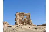
The interesting sites, except for the salt sea to the south, are all nearby on roads that go east and west. The Jiaohe Ruins dating from 100 BC to the 13th or 14th century are to the west of Turpan following a road 10 kilometers or about 6 miles. Within the Turpan city area is the Karez Wells and Karez Museum tourist site.
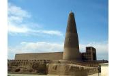
Going east out of the city on a road for about 1.6 kilometers or a mile, there is the Emin Minaret that dates to 1778 (almost as old as the United States). Following this road about a kilometer north, there is a road called G312 that goes east along the foot of the Flaming Mountains. The Flaming Mountains is a ridge of hills that runs east and west.
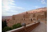
After going east for about 30 kilometers, G312 turns left. At the place it bends, there is a bus station called Huoyanshan Bus Station. At this point, three main sites can be found aligned north and south. Following G312 turning northwards and then turning left on a side road, after about 7 kilometers or 4 miles there are the Bezeklik Thousand Buddha Grottoes.
Roads going south from near the bus station go to the Astana Tombs and then further onwards to the ruins of Gaochang in Erbaoshang that are about 6 kilometers or 4 miles south of the bus station.
Near the southern edge of the Turpan basin is Lake Aiding that is the lowest point of the depression. Its water level varies, but it averages about 154 meters or 505 feet below sea level. This makes it the world’s second or third lowest salt water lake. The lowest salt water lake is in Israel, and there is one is Africa that is at the same negative elevation as the Aiding Lake.
Unusual Terrain and Climate
One cool thing about Turpan is that it has unusual weather. It is very sunny and dry, it hardly rains, and the summer temperatures are high. But because it is so dry, it makes the weather more comfortable. The basin is known as about the hottest place in China. In the summers, the temperatures in Turpan sometimes hovers about 45 degrees Celsius or about 113 degrees Fahrenheit.
Because it hardly rains, the old architecture of the ancient cities and the minaret are preserved. The old cities were made of mud and clay. Turpan is said to get about 3,200 hours of sunshine a year which means that it is usually sunny during the day. This is so sunny that China is turning part of Turpan into a model modern city that uses mainly solar energy or other types of renewable energy sources for electrification.
The weather is so dry that people can often see the moon during the day. Unless the new construction stirs up too much dust or causes too much pollution, people may find this clean and dry environment interesting and refreshing.
Much of the area around Turpan is farmland with vegetables and fruit. It is a very lush irrigated area. Water flows via underground viaducts that are thought of as one of Asia’s big ancient construction projects. They are worth a visit and are part of what makes visiting Turpan a travel highlight.
Unusual People
Uighurs are unusual people. They are a mixed people that speak a language that is related to Turkish. Visitors may not feel that they are in China. Women may wear head coverings, and the clothes are different. The food is very good because the vegetables and fruit in the region is said to be about the best in China. One interesting thing about Uighurs in Xinjiang is that an unusually high percentage of them are older than 100 years old compared to the rest of the population of China. They are Muslims and so don’t eat pork and try to eat kosher food as a rule. This also makes Turpan interesting.
Great Fruit
Despite of its extremes of temperature, Turpan is known for its grapes, watermelons of several colors, cantaloupes, apricots and raisins. Turpan produces about 80 percent of the raisins produced in China! About 85 percent of the grapes are green grapes that are air-dried. The hot and dry weather makes them sweet. There is as yet little use of pesticides, so you may find them unusually delicious. However, you may also find more pits or stones or whatever than you are used to. A half a kilogram costs about 4 RMB or 65 cents. This is about 55 US cents per pound. All this fruit can be eaten fresh. You can buy it from the Uighur farmers directly from their carts or stalls. They are known for fair and low prices and for sometimes giving fruit away. The fruit is also made into fruit juices and wines. The wines often taste unusually good though wine connoisseurs may think that the wines are primitive.
History
The region around Turpan has a history of interaction and conflicts of many peoples. Recently discovered archeological evidence like the mummies found in the Xiaohe Tombs near the far western border of Xinjiang and in other places show that 3,000 and 4,000 years ago Caucasians lived in Xinjiang. Since no Mongoloid mummies or Mongoloid people’s artifacts have been found that date before 1,000 BC, this is evidence that the original inhabitants of the area were Caucasians. It was thought that Caucasians mainly lived in Europe, so historians have been rewriting history based on DNA testing of certain mummies and the European style advanced Bronze-age clothing and artifacts that have been discovered. It is obvious that Central Asia was linked culturally to Europe. Some mummies and their artifacts can be seen in the Xinjiang Uighur Autonomous Region Museum.
Little is known about the history of the area around Turpan between 1,000 AD and 0 BC. But when trade between the Han Empire and western countries started about 100 BC, it is known that the area turned into a fortress and oasis stop area on a Silk Road route. Traders followed the base of the long ridge of the Flaming Mountains that goes east to west along the northern edge of the Turpan Basin. About 30 kilometers or about 20 miles west of modern Turpan, a large fortress city called Gaochang was built along the trade route that eventually had a royal inner area, inner walls and outer walls. It is known that it was both multi-ethnic and multi-religious because both Caucasian and Mongoloid mummies have been found in the Astana Tombs about 4 kilometers north of Gaochang. The Bezeklik Caves that are in the Flaming Mountains about 10 kilometers north was a religious site that showed paintings of both Caucasian and Mongoloid Buddhists. A Christian church was found outside the Gaochang walls. The Gaochang walls were made of rammed earth and adobe. The outer walls were about 11 meters or 37 feet high and formed almost a square. The outer wall extended 5.4 kilometers or 3.4 miles and the inner wall extended about 3.3 kilometers or 2 miles. In ancient times, the city was considered to be large. Mongols destroyed the city in the 13th century.
Jiaohe was another large fortress city that was built about the same time on a little islet in the middle of a river about 11 kilometers straight east of modern Turpan. The islet is about 1,650 meters in length and three hundred meters wide at its widest point. The river and the 30 meter high steep sides of the islet were its defenses. It is said that the Mongols destroyed the city in the 13th century also.
Skipping a lot of history, about 650 AD the Tang Dynasty conquered the area. Then the Tang were attacked by Tibet and lost much territory, and at about the same time Uyghur people took control of northern Xinjiang around 842 AD. Manichaeism was the main religion of these Uighurs. The religion is now extinct, but it was once one of the world’s major religions. Then some of the Uighurs adopted Buddhism, and others accepted Christianity.
In the 17th century, the Mongolian Dzungars established an empire over much of the region. But then the Qing Dynasty exterminated them, and it is thought that a million people were killed in a large region around Urumqi. The Qing Dynasty brought in people from other areas to resettle the area. During the middle of the 19th century, there were several big rebellions of Muslims in Yunnan, Shaanxi Province and Gansu Province. These rebellions were encouraged by the initially successful Taiping Rebellion of people who had some Christian beliefs. In 1864, the Uighurs and non-Uighur Muslims started a rebellion in the area of Xinjiang. The Qing Dynasty quickly defeated them and retook most of the lost territory.
Touring Activities
- Visit the archeological sites around Turpan.
- See the area’s scenic highlights at the sand dunes and cliffs near Bezeklik Thousand Buddha Caves, the Flaming Mountains and Aiding Lake.
- Enjoy Uyghur food made with some of the best vegetables and fruit in China.
- Sometimes you can find accommodations with the local Uighur people.
Travel Essentials
- Location: It is about 200 kilometers southeast of Urumqi in Xinjiang. Xinjiang is the far northwestern part of China.
- How to go there:
Air: Urumqi Diwopu International Airport (乌鲁木齐国际机场; IATA: URC) is about 20 kilometers north of the center of Urumqi.
Bus: National Highway G312 passes about 2 kilometers north of Urumqi, and then it goes southeast to Turpan and passes about 2 kilometers north of it going east and west. Many buses go between Urumqi and Turpan. The long-distance bus station is on Laocheng Road. Going to Urumqi takes about three hours.
Train: The train station near Turpan is called Tulufan Zhan. It is in the town of Daheyan that is about 50 kilometers NW of the center of Turpan.
- When to go: Turpan is cold in the winter. In December and January, the high temperatures average about -1 degrees Celsius or 30 degrees Fahrenheit during the day, and drop to about -10 degrees Celsius or 12 degrees Fahrenheit. During the summers in July and August, the high temperatures average about 39 degrees Celsius or 101 degrees Fahrenheit, but the dry climate makes the weather feel more comfortable than it sounds. In the evenings, the weather is warm or perfect. A lot of fresh fruit and vegetables are harvested from July to October. You might want to go then when it is cooler and eat the fruit.
- Food: Turpan Uyghur food is generally like Moslem food in the rest of China, but they use fresher ingredients. They also eat more diary products. Uighurs like dried fruits and nuts, and a typical breakfast might be bread and tea with yoghurt, almonds, olives, honey and raisins. All over China, Uighurs are known for big nutty fruitcakes that taste really good if it is well made. One good thing about Turpan’s agricultural practices is that they still haven’t started to use as much pesticides on the grapes, vegetables and fruits as farmers apply in the rest of the world. So the fruit and fruit products may taste unusually good to those who are not used to eating organically grown food.
- Pickpockets: Though the locals are probably unusually nice to non-Chinese tourists, the city is known for lots of pickpocketers and thieves who prey on tourists. So keep a watch on your stuff. It is probably best to travel with a buddy if you go off on your own. There are ATMs there for cash.
Nearby Attractions
In the city of Turpan, you can see the Karez Museum and the Emin Minaret. About ten kilometers or 6 miles to the east are the Jiaohe Ruins. The Flaming Mountains is a ridge of hills that runs east and west just north of the city. Three historical sites are near each other in the west. The Bezeklik Thousand Buddha Grottoes are about 37 kilometers to the west. The Astana Tombs are about 32 kilometers west, and the Gaochang Ancient City site is about 37 kilometers west. Near the southern edge of the Turpan basin is Lake Aiding that is the world’s second or third lowest salt water lake. The lowest salt water lake is in Israel, and there is one is Africa that is at the same negative elevation as the Aiding Lake.
The mountain natural scenery and hiking areas near Urumqi and Turpan include the Heavenly Lake(天池) that is east of Urumqi on Bogda Mountain at an elevation of about 2,000 meters or about 6,500 feet. The beautiful highland lake is flanked by rugged peaks with pines and cypresses and has clear water that reflects the surrounding mountains. You can camp in Kazakh yurts there, and some hikers go up Bogda Peak to see glaciers. For some easier hiking, Kazakh yurt accommodations and Kazakh meals, there is a grass covered mountain area called the South Pastures about two hours south of Urumqi. You can also travel by hired vehicle to go see Number One Glacier that is south of it.
Urumqi is a base for touring the area, and the highlights in Urumqi include the Xinjiang Uighur Autonomous Region Museum (Qu Bowuguan, 自治区博物馆, 132 Xi Bei Lu) that often has very ancient Caucasian mummies and their artifacts and the International Bazaar (新疆国际大巴扎) that is an interesting place to shop. Next to the bazaar is Xinjiang Silk Road Museum (新疆丝绸之路博物馆) on No. 160 Shengli Road. You can learn about the ancient Silk Road and some about the region and its history.
Tips & articles
|
|
|
forum discussion
|
|
|


