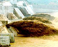
 The Yellow River Water Conservancy Committee has recently approved the construction plan of "model Yellow River," marking the total approval from the competent authority of "prototype Yellow River" "digital Yellow River" and "model Yellow River." Now the three modern harnessing strategies have been fully implemented.
The three modern Yellow River harnessing ideas are called "three Yellow Rivers" in Chinese. According to them, water conservancy of the Yellow River in the future is to be divided into three steps. The first step is to analyze status quo of the river and put forward basic requirements for harnessing it and related physical parameters; the second step is to carry out digitized simulation and work out general plans via modern information technology; the third step is to experiment on model Yellow River and finally provide a technically-advanced, economic, safe and effective harnessing program for the real river.
To elaborate on the "three Yellow Rivers" strategies, Yao Wenyi, chief engineer of the Yellow River Conservancy Science Academy, cited an example: in the optimization design, if experiments on the model Yellow River prove it workable to reduce a certain dam, the actual investment in the project will decrease by 2 to 3 million yuan (US2,000-362,000). What's more, through flood previews on the model Yellow River, it could be predicted which section is likely to have dangers, and consequently which section would be taken as priority in anti-flood contingency plans and local civilians could be removed in advance.
In the flood season of 2003, the practice of the "three Yellow Rivers" strategies played a big role in anti-flood deployment and direction, said Yao Wenyi.
According to the "three Yellow Rivers" harnessing plan, by 2010, an improved system of flood prevention and silt reduction will be formed along the Yellow River, and water resources be managed effectively. This could help guarantee that the river does not run dry in years with normal weather conditions and enlarge the area of the Loess Plateau under water and soil conservation to 1.2 billion square kilometers. Also, 160,000 dams are to be built to reduce silt flowing into the river by 300 million tons.
(China.org.cn)
Related News
Photos
More>>trade
- Jinan Government Held the 47th Standing Conference
- The Working Conference on Governmental Service Was Held
- A Forest Park in the Western Suburbs Will Be Opened for Free in this October
- Jinan-Singapore International Service Newly Opened in Jinan
- Jinan Municipal Bureau of Public Security Held a Conference on Legislative Work


