Home Facts china

CEODE Obtained First Batch High-resolution Airborne Remote Sensing Data of Yushu Earthquake

CEODE Obtained First Batch High-resolution Airborne Remote Sensing Data of Yushu Earthquake

Write: Zaccheo [2011-05-20]
CEODE's remote sensing aircrafts rushed to the quake-hit areas at 13:56 of April 14, 2010, which gave rise to the first batch of 40cm high-resolution airborne remote sensing data at 15:30. Fig.1 shows the collapsed houses within 24km areas from the Yushu epicenter, while Fig.2 is a high-resolution airborne remote sensing image at the same location.

CEODE Obtained First Batch High-resolution Airborne Remote Sensing Data of Yushu Earthquake

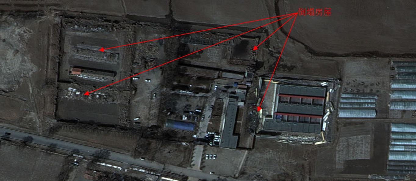
Fig.1 (Image by CEODE)
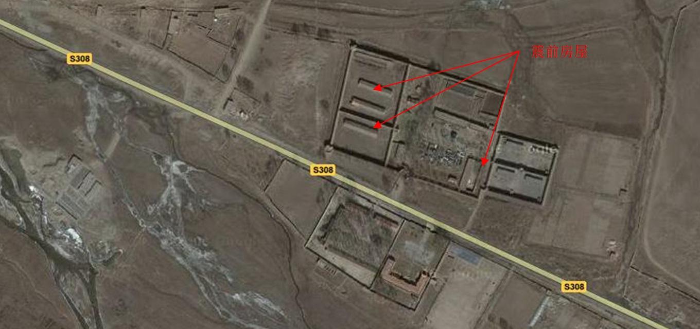
CEODE Obtained First Batch High-resolution Airborne Remote Sensing Data of Yushu Earthquake

Fig.2