On 12 May, 2010, two years after the devastating Wenchuan Earthquake, Center for Earth Observation and Digital Earth, Chinese Academy of Sciences collected a large quantity of aerial remote sensing optical and radar data over the earthquake-hit areas of Wenchuan County, Sichuan Province.
In combination with the last two year s remote sensing results, the air-space-land studies made significant advances in assessing the current risk and current conditions of local environments and post-quake construction in a typical area (e.g., Beichuan County, Tangjiashan Barrier Lake, Yingxiu, etc). With the new data and information obtained in 2008 and 2009, scientists completed a comparative analysis of local environmental restoration, surface rupture zones, and post-quake construction.
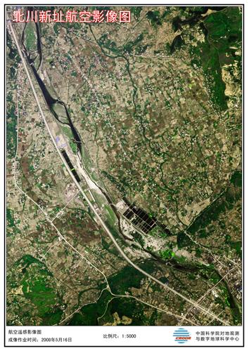
The new county seat of Beichuan County (May 16, 2008)
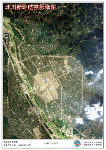
The new county seat of Beichuan County (May 16, 2009)
Related News
- Exceptional Dinosaur Fossils Show Ontogenetic Development of Early Feathers
- CAS Launches High-Performance Distributed GPU Supercomputing System
- U.S., Russian Scientists Cooperate with Scientists of IHB on Research of Yangtze Finless Porpoises
- CAS Sends Rescue Team to the Earthquake-Stricken Yushu County