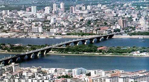
(File photo)
According to Changsha s 12th Five-Year Plan (Draft, 2011-2015), efforts will be exerted to appropriately expand the downtown area of the city. Attention will be paid to promoting scientific and well-planned spatial development,, and stepping up the pace of shaping an urban spatial texture featured by one axis, two belts, one core area and seven districts. ( One axis is the principal landscape axis in the center. "Two belts are the two belt-like open greenspaces.
In addition, initiatives will be taken in the city to ensure rational layout of the major infrastructure facilities, improve comprehensive service function and promote city cluster development.
What would Changsha city look like 5 years later? Wang Huifang, chief engineer of the Changsha Urban-Rural Planning Administration Bureau, said that until then Changsha will have been built into a high-speed railway hub connecting Wuhan-Guangzhou railway and Shanghai-Kunming railway as well as an aviation hub accessible to a number of international airlines. While within the province, it will also have been developed into a happy and livable city with balanced development along both banks of Xiangjiang River.
The two high-speed railways Changsha linking are Wuhan-Guangzhou railway and Shanghai-Kunming railway. The former has been completed and operated for a year, and the latter is scheduled to open to public within 4 years. The high-speed transportation hub formed by these two railways will foster a window to the outside world along both banks of Liuyang River and become a sub-center of Changsha.
The planning and construction that implemented in the Changsha Pioneering District on the west of the Xiangjiang River has thoroughly transformed the city layout proposed in the 1990s and fulfilled the aspiration of "balanced development along both banks of Xiangjiang River".
Translator: Chen Yu
Related News
Photos
More>>trade
- Over 8,000 Infringing Products Destroyed in Changsha
- Credit Card Tailored for Shaoyang Merchants Debuts in Changsha
- Fiscal Revenue of Changsha County Hits 1.16 Bln Yuan in First 20 Days of 2011
- Changsha Commends Entrepreneurship Stars
- Changsha's Total Tourism Revenue in 2010 Ranks 8th Among Provincial Capital
market
- Songya Lake of Changsha Begins Storing Water
- Hunan Launches Pilot Reform of PSBC Financial IC Card System
- The 60th Anniversary of Hunan People's Publishing House Celebrated
- Changsha: 12,000 People Sweep Snow to Ensure a Smooth Traffic
- Hunan's First Spring Festival Gala for the Elderly Held in Changsha 2011
finance
- Research Report on China's TV Industry Development First Released in Changsha
- Four Chimpanzees to Spend the Spring Festival in Changsha
- "China's National Image Film: Figures" Debuts in New York
- Changsha's First Subway Station Completed
- Hunan's First English-medium International School Set up in Changsha


